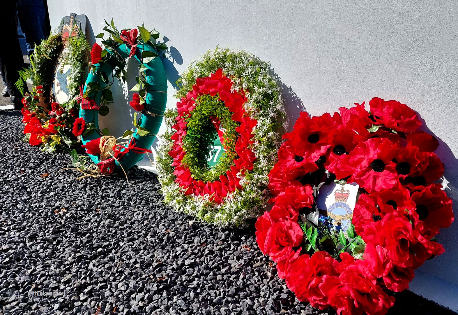
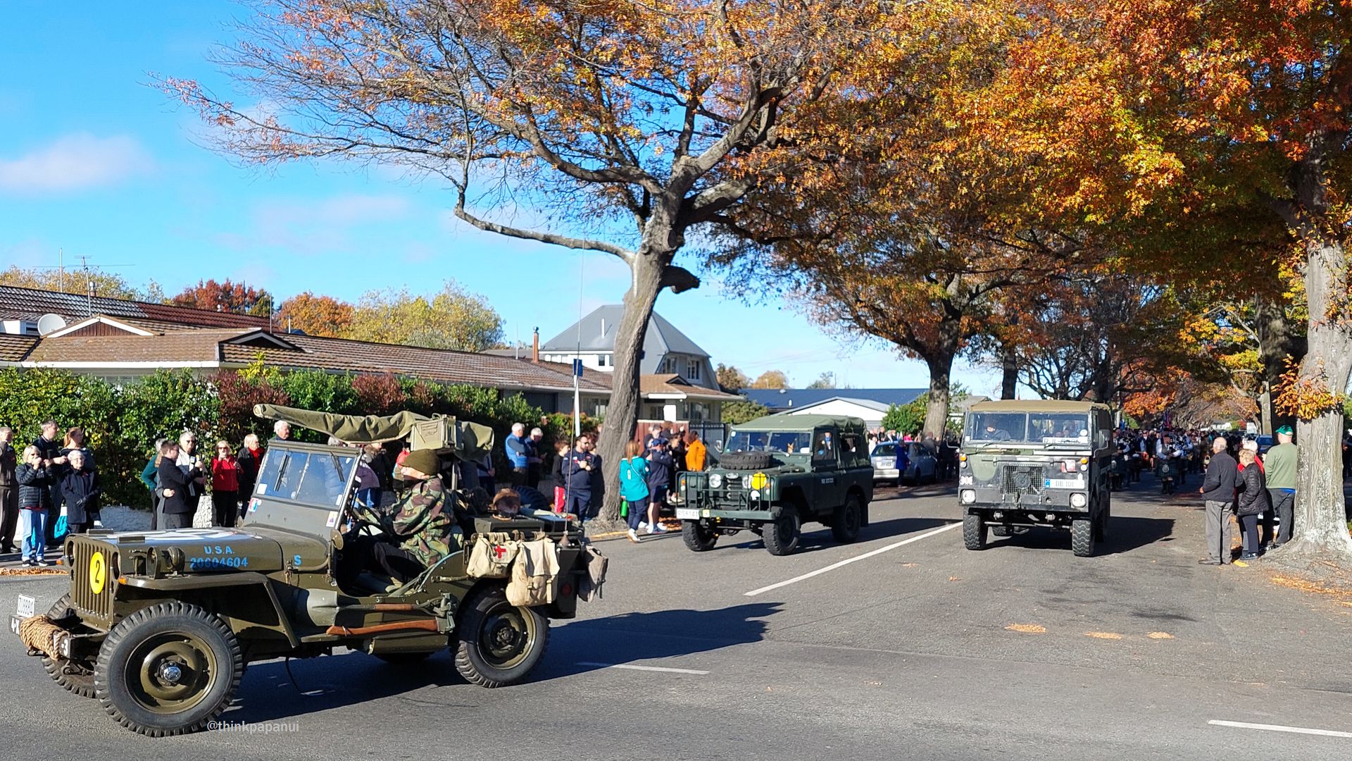
Today the Papanui RSA hosted an Anzac Day service for the last time on their current Harewood Road site. A notable inclusion in the parade were Australian and New Zealand athletes, in town for the Trans Tasman touch competition. (For now, the RSA continues to operate on Harewood Road, but the site has been sold and the association will be on the move at some point in the future.)
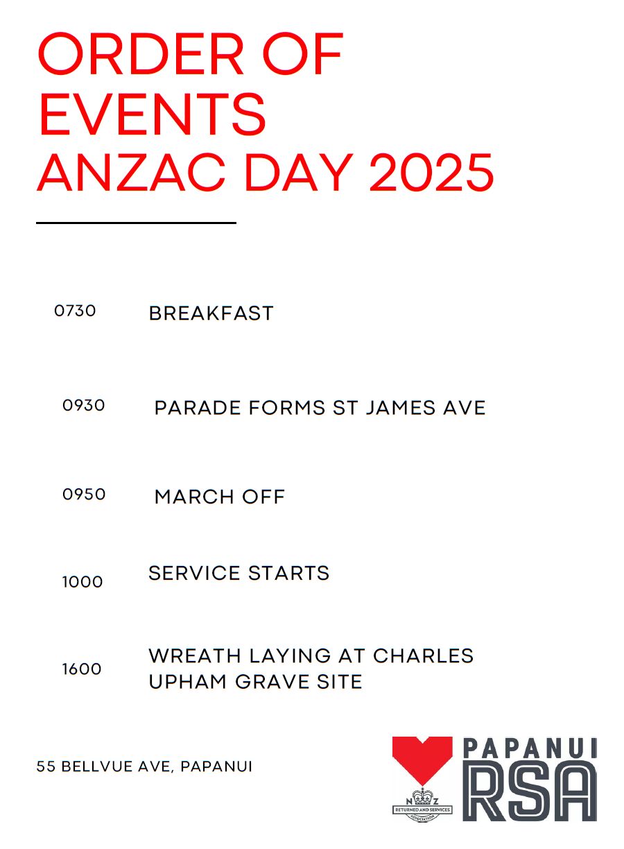
There’ll be an Anzac Day service hosted by the Papanui RSA at 10am on Friday 25 April, with the parade forming in St James Avenue at 9:30am. Parking is available in the Mitre 10 car park until midday.
Other Anzac Day services and events include a dawn service in Cathedral Square (6:30am) and a Citizen’s Service at 10am in the Transitional Cathedral, as well as numerous local events.
If Friday is your usual kerbside collection day, please note the following changes: Good Friday bin collections move to Saturday 19 April 2025; and Anzac Day bin collections move to Saturday 26 April 2025. There are no changes to collections on Easter Monday.
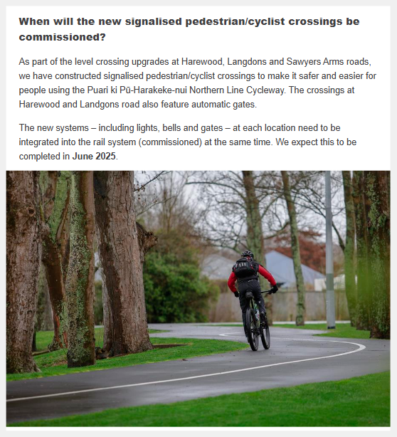
The Council has advised that the signalised crossings on Harewood, Langdons, and Sawyers Arms Roads are set to be commissioned in June 2025.
Upgrade works at all three crossings had to be completed before the switchover can happen from the old signalling system to the new one, and construction work on the last of the three (Sawyers Arms Road) is now winding down.
For more information on the project, including the option to subscribe to email updates, head to the project webpage.
The Government’s Setting of Speed Limits Rule 2024 requires the Council to implement variable speed limits of 30km/h during ‘school travel periods’ outside of all Ōtautahi Christchurch and Te Pātaka o Rākaihautū schools.
Streets adjacent to the following schools are included in the proposal: Papanui Primary; St Bede’s College; Redwood Primary; Te Kura o Matarangi – Northcote School; Casebrook Intermediate; Marian College; Bishopdale School Te Kura o Papakōhatu; Wairakei School; Waimairi School; and St Andrew’s College.
Click through for full details of the Council’s proposal, noting that feedback is being requested specifically from kura/schools: https://letstalk.ccc.govt.nz/schoolspeeds
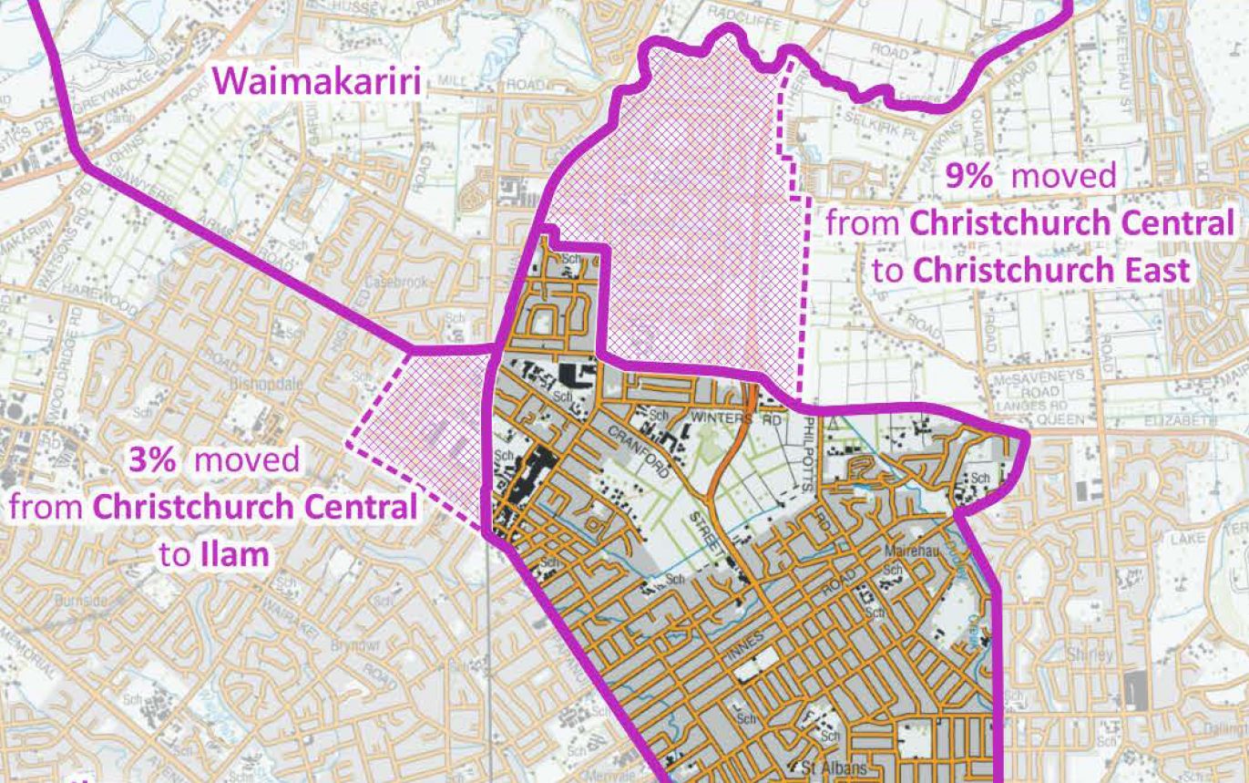
Proposed electorate boundary changes will see parts of Papanui change from Christchurch Central to Ilam, and Redwood will mostly change from Christchurch Central to Christchurch East.
The Representation Commission is proposing the changes as part of a nationwide review of electorate boundaries, driven by the need to ensure each electorate has about the same number of residents. The proposed changes are open for public feedback until 27 April 2025.
Final electorate boundaries will be released in August this year, following a public hearings process, and will apply from the 2026 General Election. This process does not affect ward and constituency boundaries for this years local government elections.
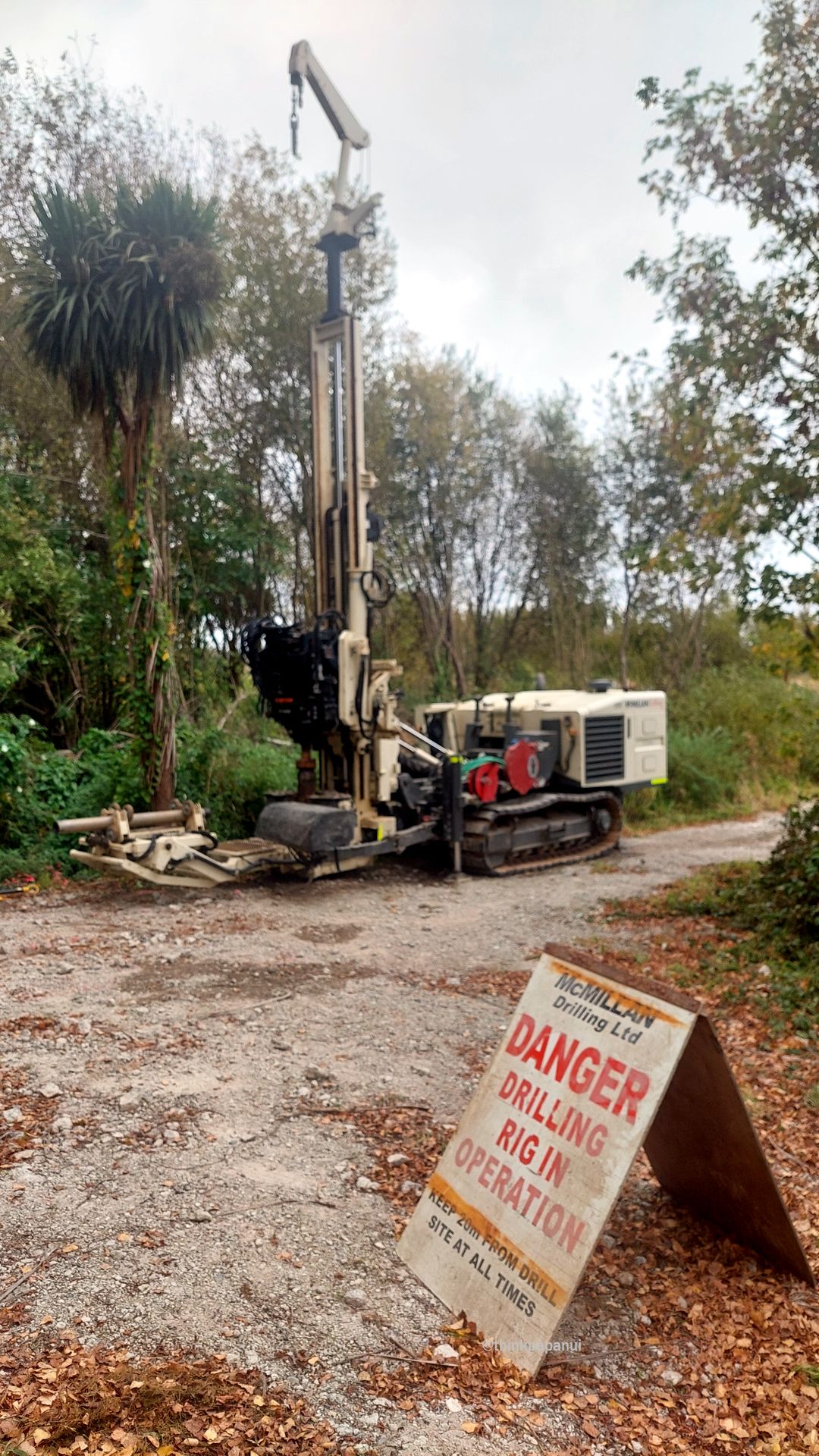
Geotechnical drilling equipment was spotted on site in Cranford Basin last week. The southern part of the basin is subject to a Fast Track consent application that proposes approximately 528 residential dwellings.